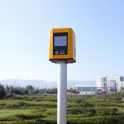
logo
خانه محصولاتداپلر باد لیدار

Vertical Range minus 10 to 190 degrees remote data collection tool featuring 4 kilometer vertical measuring distance tailored for industrial

گواهی
چین Nanjing Movelaser Co., Ltd. گواهینامه ها
نظرات مشتریان
من از نگرش خدمات پس از فروش بسیار راضی هستم، کیفیت محصول عالی است، و امیدوارم که به حفظ آن ادامه دهم

—— ليونگ شيونگ

محصولات شرکت شما عملکرد عالی و کیفیت عالی را در طول کار نشان داده اند،ارائه حمایت قوی در سناریوهای مانند اندازه گیری باد پروژه اولیه و ارزیابی عملیاتی پروژه; تیم شما پاسخ به موقع، ارتباطات موثر و خدمات متفکرانه در نصب تجهیزات، نگهداری را فراهم می کند.

—— "یوندا لی"

پس از اینکه محصول مشکل پیدا کرد، پس از فروش می توان به سرعت با آن برخورد کرد. توصیه می شود محصول را برای محیط های بیشتر مناسب کنید.

—— جیمین فو

به طور کلی من بسیار راضی هستم و امیدوارم همچنان تجهیزات راداری پیشرفته تر، قابل اعتمادتر و پایدارتر را در اختیار ما قرار دهم.

—— فن یانگ

امید است که محصولات همچنان بهینه، به روز و تکرار شوند، کیفیت پایدارتر باشد و خدمات، تحویل و پس از فروش همچنان کیفیت بالا را حفظ کند و به سطح پیشرو در صنعت دست یابد.

—— یووی وانگ

تحویل محصول، پردازش تجهیزات بسیار به موقع است

—— لانگ چن

نگرش مثبت پرسنل بازاریابی، خدمات پس از فروش به موقع

—— کای ژائو

به کار سخت، همکاری برد-برد ادامه دهید

—— یویان زی

تجهیزات و خدمات بسیار خوب است و من مشتاقانه منتظر ادامه همکاری در آینده هستم.

—— مینگجی ژو

نصب این تجهیزات آسان است و برای آزمایش واحد مناسب است.

—— لوک وانگ

لیدار بادی زمینی عملکرد خوبی دارد و توسط سازندگان ماشین آلات داخلی و کامل ما به رسمیت شناخته شده است و هیچ اعتراضی به نتایج آزمایش وجود ندارد. کارکنان فروش دارای دانش فنی گسترده و پاسخ های حرفه ای هستند. کارکنان در محل فعال هستند و مشتاقانه منتظر همکاری مجدد هستند.

—— کانپنگ لو

در سرویس نصب رادار، پرسنل بازاریابی دارای نگرش خوب، توانایی فنی قوی و حل مشکلات در محل هستند که تضمین محکمی برای حمل و نصب لیدار است.

—— لیانگ گائو

این سیستم اندازه گیری باد به طور کامل جمع آوری داده های ما را تغییر داده است. دقت و ثبات آن حتی در شرایط سخت، فوق العاده است.تیم پشتیبانی فنی فوق العاده حرفه ای هستند!

—— جیمز ام

از زمان استقرار دستگاه‌های LiDAR شما، راندمان ارزیابی مزرعه بادی ما حداقل 40٪ افزایش یافته است. این دستگاه نه تنها قابل اعتماد است، بلکه کاربرپسند نیز هست. به هر کسی در این زمینه اکیداً توصیه می‌شود!

—— سوفیا چن

دقت فوق‌العاده و دوام باورنکردنی! ایستگاه‌های میدانی ما مدت‌هاست که به این تجهیزات متکی هستند و هرگز ما را ناامید نکرده است. ترکیبی عالی از فناوری پیشرفته و طراحی کاربردی.

—— احمد الفارسی

به عنوان یک محقق، من از بالاترین دقت داده ها تقاضا می کنم. این سیستم از همه انتظارات فراتر رفته است. مصرف انرژی پایین و ادغام آسان آن به طور قابل توجهی پروژه ما را تسریع کرده است.

—— الينا روسي

پایدار، دقیق، و تقریباً بدون نیاز به تعمیر و نگهداری - دقیقاً راه‌حل درجه صنعتی که ما نیاز داشتیم. این به ما کمک کرده است تا خروجی انرژی را بهینه کنیم و در عین حال هزینه‌های عملیاتی را به میزان قابل توجهی کاهش دهیم.

—— توماس هِرِرا

از مشاوره پیش از فروش تا آموزش فنی، تجربه خدمات بی عیب و نقص بوده است. تجهیزات عملکرد عالی دارند و بینش های مهمی را برای پروژه های انرژی بادی مشتریان ما ارائه می دهند.

—— پریا شارما

ما چندین محصول مشابه را آزمایش کرده ایم، اما این سیستم به دلیل ثبات طولانی مدت و ثبات داده ها برجسته است.

—— بیورن لندگرن

چت IM آنلاین در حال حاضر

Vertical Range minus 10 to 190 degrees remote data collection tool featuring 4 kilometer vertical measuring distance tailored for industrial

Vertical Range minus 10 to 190 degrees remote data collection tool featuring 4 kilometer vertical measuring distance tailored for industrial

تصویر بزرگ :  Vertical Range minus 10 to 190 degrees remote data collection tool featuring 4 kilometer vertical measuring distance tailored for industrial

جزئیات محصول:
نام تجاری: MOVELASER
Model Number: 3D Scanning Doppler Wind Lidar Molas 3D
پرداخت:
Minimum Order Quantity: 1 Set
Packaging Details: Air Box
Delivery Time: 1-2 Months
Payment Terms: L/C, D/A, D/P, T/T
Supply Ability: 200 Set ,1 Month
توضیحات محصول جزئیات
Size: 756mm*735mm*1000mm Sight Detection Distance: 10km
Maximum Acquisition Distance: 15km Distance Resolution: 15m/30m/75m/120m
Sight Wind Speed Accuracy: 0.1m/s Weight: ≤100kg
Pointing Acuracy: ±0.005° DataStorage Time: 5to18months
برجسته کردن:

Doppler Wind Lidar remote data collection,Doppler Wind Lidar 4km measuring distance,Doppler Wind Lidar industrial vertical range

,

Doppler Wind Lidar 4km measuring distance

,

Doppler Wind Lidar industrial vertical range

Product Description:

Molas 3D is an advanced Doppler wind measurement lidar that operates using three-dimensional scanning technology. It utilizes the principle of pulsed laser coherent Doppler frequency shift to accurately capture wind speed data.

This innovative device supports multiple scanning modes, including P-Pl, RHI, DBS, and program scanning. Such versatility allows it to be tailored for specific wind speed measurement requirements across various applications.

The Molas 3D lidar is well-suited for a wide range of customized scenarios. These include offshore wind resource assessment, research in complex terrains, wind turbine wake detection, and airport glide path wind shear warnings. Additionally, it is valuable for urban meteorological observations and detecting high-altitude turbulence.


Features:

Comprehensive Measurement Capabilities

The system offers detailed measurement information by utilizing a refined 3D wind field measurement technique. It supports up to 300 customizable distance layers, allowing for precise and tailored data acquisition.

Wide Detection Range

Equipped with a large detection range, the device can monitor sight distances up to 10 kilometers, particularly effective at altitudes below 600 meters.

High Accuracy Performance

This technology ensures exceptional precision, featuring a pointing accuracy of 0.005 degrees and a visual direction wind speed accuracy of 0.1 meters per second.

Diverse Scanning Methods

Multiple scanning techniques are supported, including PPl, RHl, DBS, and a programmable arbitrary scan method, allowing for versatile operational modes based on varying measurement needs.

Flexible and Lightweight Deployment

Designed to be small and lightweight, the system facilitates easy transportation and rapid deployment in different environments.

All-Weather Durability

Built to withstand harsh outdoor environments, it offers survivability in LPz0 and features lightning protection zones, ensuring reliable operation regardless of weather conditions.

Safety and Security Features

Safety is paramount, with integrated GPS location reporting and geo-fencing capabilities. Additionally, data encryption safeguards against any risk of information leakage.

Multiple Configuration Options

Users can select from four distance resolutions and five accumulation times, providing flexibility to tailor the system’s operation to specific requirements.


Technical Parameters:

Vertical Range -10~190°
Sight Detection Distance 10 km
Sight Wind Speed Range -75~+75 m/s
Distance Resolution 15 m / 30 m / 75 m / 120 m
Sight Wind Speed Accuracy 0.1 m/s
Distance Layers Up to 300
Pointing Accuracy ±0.005°
Accumulation Time 0.2~10 s (Optional)
Data Storage Time 5 to 18 months
Vertical Measuring Distance 4 km

Applications:

Wind resource assessment involves collecting wind field data over extensive areas, which helps to minimize the risks associated with site selection for wind energy projects. By accurately measuring wind parameters, it ensures better planning and utilization of wind resources.

Long-distance power curve measurements and wake eddy current assessments play a significant role in optimizing wind energy utilization. These measurements contribute to improving the efficiency of wind energy units by providing detailed insights into wind flow dynamics and turbine performance.

Early detection and warning systems are essential for identifying dangerous meteorological phenomena, such as wind shear and microbursts. Timely warnings can enhance safety measures in aviation and other weather-sensitive operations.

Measuring wake vortices is crucial for optimizing flight separation at airports. By understanding these vortices, air traffic controllers can better manage aircraft spacing, thereby increasing airport traffic efficiency and safety.

Providing detailed wind field information aids in understanding the behavior of wind within the atmospheric boundary layer. This data is vital for meteorological studies and improving weather forecasting models.

Accurate and high spatiotemporal wind profile measurements near the surface, within a few kilometers, help fill the observation gaps at low altitudes. This enhanced data resolution supports various applications ranging from environmental monitoring to renewable energy development.

Real-time three-dimensional information about plume dispersion enables effective tracking of emission sources. Such monitoring is particularly valuable for environmental management and controlling air pollution.

Additionally, optimizing dust emission control in the mining industry relies on precise wind and dispersion measurements. These techniques help minimize environmental impacts and enhance operational safety in mining activities.


اطلاعات تماس
Nanjing Movelaser Co., Ltd.

تماس با شخص: Miss. ivyyao

تلفن: +86 13072523225

فکس: 86-025-86800073

ارسال درخواست خود را به طور مستقیم به ما (0 / 3000)

سایر محصولات